The spit and the settlement at Pauline Cove") (Photo: Jaroš Obu) The spit and the settlement at Pauline Cove
(Photo: Jaroš Obu) The spit and the settlement at Pauline Cove
Monday, 22nd of August 2014
If you look closely at the map of Herschel Island, you will see long stretches of land extending from the island into the sea. These landforms are made of sand and pebbles and are called spits. The spit in the shape of a hook close to the eastern tip of the island is where our base is situated.
 Samuel is taking a water sample for chemistry measurements") (Photo: Jaroš Obu) Samuel is taking a water sample for chemistry measurements
(Photo: Jaroš Obu) Samuel is taking a water sample for chemistry measurementsThe reason for locating base there is mostly the absence of permafrost on spits, which makes the ground unlikely to be affected by vertical movements that would damage the buildings. There is no permafrost under the spits because of the vicinity of sea water, which is keeping ground temperatures above 0°C.
All the spits were formed fairly recently in geological times and are much more modern than the rest of the island. They were built by eroded sediment that was transported along the coast and then deposited. That said, not all the eroded and transported sediment ended up being deposited in spits. The fate of the rest is what interests us.
Gavin is trying to understand where this sediment is being transported. To do so, he sets up instruments measuring the wave action, sea currents and tides. At the beginning of the season, he deployed an Acoustic Doppler Current Profiler (ADCP) to look at currents in 3D in the water column as well as several pressure transducers. Pressure transducers measure the pressure at the sea bottom which is then converted to sea level and even wave height if the instrument is measuring in the high frequency.
When the sea conditions were not too rough, George made boat trips to selected points around the island to get water samples and measure in-situ physical characteristics of the water. He measured the conductivity, temperature, pH and salinity of water and will do other organic and inorganic chemistry at the laboratory, once the samples are back in Germany. He wants to find out how the organic carbon that is released by erosion is being transported under different weather situations.
 Nina while retrieving penetrometer") (Photo: Brandon Quinn) Nina while retrieving penetrometer
(Photo: Brandon Quinn) Nina while retrieving penetrometerNina and Brandon joined the expedition for the last two weeks. They tested the physical and geotechnical sediment characteristics of the sea floor with a portable free-fall penetrometer. The torpedo shaped device measures the forces from the impact with sediment when dropped into the water. The geotechnical sediment signatures will reveal and quantify most recent sediment deposition and erosion, and help understanding the soil mechanical processes the sediment underwent after deposition.
Just two days before our departure, as Gavin and Ute were supposed to fly out early to Inuvik, the weather turned nasty again and prevented any flights. The thin fog veiled the island and made any airplane landings impossible. We were packing our last equipment, when the fog was gone in the evening and then watched the new mists forming again after the sunset. We were all anxious about the next day, when our flight back to Inuvik was scheduled.
We awoke in a sunny morning. But the look around revealed that there was fog all around us. Just when the plane was arriving, the fog approached the landing strip and the pilot didn't manage to land in two tries. Then she tried a skilful manoeuvre, descended from the side with better visibility and landed safely. To our relief, the wind started to cooperate with us and blew the fog further away. We were able to fly out to Inuvik to start the last chapter of our expedition.
Written by Jaroš, Hugues and Nina


 The PAGE21 project has now been officially closed. The four years of research came to an end on October 31 2015, leaving only...
 PAGE21 project was featured in a plenary session "Permafrost in the 21st century" at the 2015 Arctic Circle conference in Reykjavik,...
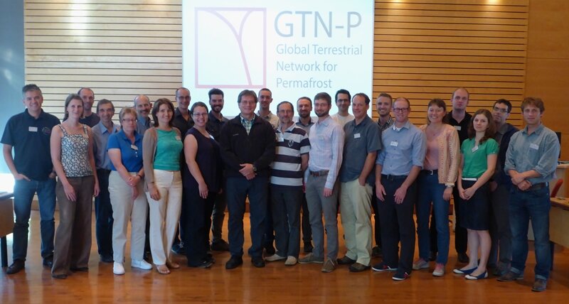 The 2nd GTN-P National Correspondents Workshop, held in Quebec, Canada, 19-20 September 2015, accomplished the data policy and...
 The spit and the settlement at Pauline Cove") (Photo: Jaroš Obu) The spit and the settlement at Pauline Cove
(Photo: Jaroš Obu) The spit and the settlement at Pauline Cove
 Samuel is taking a water sample for chemistry measurements") (Photo: Jaroš Obu) Samuel is taking a water sample for chemistry measurementsThe reason for locating base there is mostly the absence of permafrost on spits, which makes the ground unlikely to be affected by vertical movements that would damage the buildings. There is no permafrost under the spits because of the vicinity of sea water, which is keeping ground temperatures above 0°C.
(Photo: Jaroš Obu) Samuel is taking a water sample for chemistry measurementsThe reason for locating base there is mostly the absence of permafrost on spits, which makes the ground unlikely to be affected by vertical movements that would damage the buildings. There is no permafrost under the spits because of the vicinity of sea water, which is keeping ground temperatures above 0°C.
 Nina while retrieving penetrometer") (Photo: Brandon Quinn) Nina while retrieving penetrometerNina and Brandon joined the expedition for the last two weeks. They tested the physical and geotechnical sediment characteristics of the sea floor with a portable free-fall penetrometer. The torpedo shaped device measures the forces from the impact with sediment when dropped into the water. The geotechnical sediment signatures will reveal and quantify most recent sediment deposition and erosion, and help understanding the soil mechanical processes the sediment underwent after deposition.
(Photo: Brandon Quinn) Nina while retrieving penetrometerNina and Brandon joined the expedition for the last two weeks. They tested the physical and geotechnical sediment characteristics of the sea floor with a portable free-fall penetrometer. The torpedo shaped device measures the forces from the impact with sediment when dropped into the water. The geotechnical sediment signatures will reveal and quantify most recent sediment deposition and erosion, and help understanding the soil mechanical processes the sediment underwent after deposition.