Cherkii-area: map of area around Cherskiy, with the city, the station (NESS = North east science station: http://www.pleistocenepark.ru/en/) and our site.") (Map: Google Earth edited by M. Hertel) Cherkii-area: map of area around Cherskiy, with the city, the station (NESS = North east science station: http://www.pleistocenepark.ru/en/) and our site.Friday, 12th of July 2013
(Map: Google Earth edited by M. Hertel) Cherkii-area: map of area around Cherskiy, with the city, the station (NESS = North east science station: http://www.pleistocenepark.ru/en/) and our site.Friday, 12th of July 2013
The town of Cherskiy is situated about 3 km to the west of the Northeast Scientific Station where we're currently staying. It provides all the central facilities for the area, and is also the only connection of the area to the rest of the world. Its airport offers flights to the city of Yakutsk in central Eastern Siberia about 5 times per week, about 2000 km and a four hour flight away.
The city is the administrative center of Nizhnekolymsky District of the Sakha Republic, Russia, and is populated by about 3000 inhabitants.
In former times, during the cold war the city was used as a military station to test military equipment under extreme climatic conditions. About 30000 people used to live here, but today most of them left due to the hard life in the remote area without any kind of industry left.
 Impressions from Cherskiy city. From left to right: Fanny Kittler, Martin Heimann, Martin Hertel, Olaf Kolle, Min Jung Kwon.") (Photo: M. Heimann) Impressions from Cherskiy city. From left to right: Fanny Kittler, Martin Heimann, Martin Hertel, Olaf Kolle, Min Jung Kwon.
(Photo: M. Heimann) Impressions from Cherskiy city. From left to right: Fanny Kittler, Martin Heimann, Martin Hertel, Olaf Kolle, Min Jung Kwon.Cherskiy is named after the
polish explorer Jan Czerski, who organized several expeditions in the surrounding area in the 1880.
Furthermore a mountain range to the southwest of the city is also named after him. The city is located at the banks of the Kolyma River, 100 km upstream from the Arctic Sea.
The Kolyma is one of the main rivers of Russia, with a total length of 2130 km and a basin size of 644,000 km2. During the winter it is frozen up to a depth of 1.5 meters and during these times the Cherskiy airport is shifted from the land to the river. After the ice breaks up flooding appears during spring.
Yesterday we decided to make a 'sightseeing tour' through Cherskiy. Earlier, I saw parts of the city when we were passing from the airport to the station, but I have to admit I was too tired to get a good impression from just driving through, and what I saw didn't look too promising.
 Pesidential on stilts in Cherskiy.") (Photo: F. Kittler) Pesidential on stilts in Cherskiy.
(Photo: F. Kittler) Pesidential on stilts in Cherskiy. Because many people left the city during the last decades, lots of
buildings are neglected or even deserted, which leaves the impression of something like a
ghost city.
Now that we visited the city by feet in the afternoon I could get a better insight and the impression has changed. The city was very lively and you can see that the people are trying hard to keep everything running.
They definitely try their best to deal best with the harsh situation here in the north. I have a lot of respect for the people who still live here and are able to "survive" - I can image that this not as easy as it seems in the winter time with temperatures around -40°C.
The local museum, which we also visited two days later, was very impressive. For such a small city without tourism, the collection was quite impressive. We learned a lot about the local traditions and the way people are living in the northern parts of Russia as well as the regional nature and wildlife.
 Airport in Cherskiy") (Photo: F. Kittler) Airport in Cherskiy
(Photo: F. Kittler) Airport in CherskiyConcerning our actual project here, we're unfortunately
still waiting for our boxes with equipment to arrive. After some delays in customs there were some more minor problems with the air cargo shipment which cost us another few days, and in the end this resulted in the boxes missing the cargo plane from Yakutsk to Cherskiy that would have brought them here in time.
Currently, the instruments are stuck at Yakutsk airport and we have to wait for the next cargo plane to get them here. It is a bit frustrating to see our time here passing by without starting your actual work.
Fortunately, within certain limitations it's possible to conduct some more intensive surveying projects on the observation site to prepare for the actual carbon flux measurements.
Written by Fanny


 The PAGE21 project has now been officially closed. The four years of research came to an end on October 31 2015, leaving only...
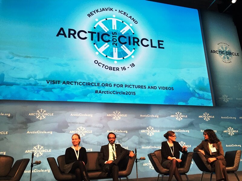 PAGE21 project was featured in a plenary session "Permafrost in the 21st century" at the 2015 Arctic Circle conference in Reykjavik,...
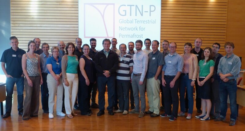 The 2nd GTN-P National Correspondents Workshop, held in Quebec, Canada, 19-20 September 2015, accomplished the data policy and...
 Cherkii-area: map of area around Cherskiy, with the city, the station (NESS = North east science station: http://www.pleistocenepark.ru/en/) and our site.") (Map: Google Earth edited by M. Hertel) Cherkii-area: map of area around Cherskiy, with the city, the station (NESS = North east science station: http://www.pleistocenepark.ru/en/) and our site.Friday, 12th of July 2013
(Map: Google Earth edited by M. Hertel) Cherkii-area: map of area around Cherskiy, with the city, the station (NESS = North east science station: http://www.pleistocenepark.ru/en/) and our site.Friday, 12th of July 2013
 Impressions from Cherskiy city. From left to right: Fanny Kittler, Martin Heimann, Martin Hertel, Olaf Kolle, Min Jung Kwon.") (Photo: M. Heimann) Impressions from Cherskiy city. From left to right: Fanny Kittler, Martin Heimann, Martin Hertel, Olaf Kolle, Min Jung Kwon.Cherskiy is named after the polish explorer Jan Czerski, who organized several expeditions in the surrounding area in the 1880.
(Photo: M. Heimann) Impressions from Cherskiy city. From left to right: Fanny Kittler, Martin Heimann, Martin Hertel, Olaf Kolle, Min Jung Kwon.Cherskiy is named after the polish explorer Jan Czerski, who organized several expeditions in the surrounding area in the 1880.
 Pesidential on stilts in Cherskiy.") (Photo: F. Kittler) Pesidential on stilts in Cherskiy. Because many people left the city during the last decades, lots of buildings are neglected or even deserted, which leaves the impression of something like a ghost city.
(Photo: F. Kittler) Pesidential on stilts in Cherskiy. Because many people left the city during the last decades, lots of buildings are neglected or even deserted, which leaves the impression of something like a ghost city.
 Airport in Cherskiy") (Photo: F. Kittler) Airport in CherskiyConcerning our actual project here, we're unfortunately still waiting for our boxes with equipment to arrive. After some delays in customs there were some more minor problems with the air cargo shipment which cost us another few days, and in the end this resulted in the boxes missing the cargo plane from Yakutsk to Cherskiy that would have brought them here in time.
(Photo: F. Kittler) Airport in CherskiyConcerning our actual project here, we're unfortunately still waiting for our boxes with equipment to arrive. After some delays in customs there were some more minor problems with the air cargo shipment which cost us another few days, and in the end this resulted in the boxes missing the cargo plane from Yakutsk to Cherskiy that would have brought them here in time.