At the top of Rodinka looking northwest.") (Photo: Fanny Kittler) At the top of Rodinka looking northwest.Tuesday, 16th of July 2013
(Photo: Fanny Kittler) At the top of Rodinka looking northwest.Tuesday, 16th of July 2013
3 days ago we went to "Rodinka", a prominent hill close to our station overlooking the floodplain of the Kolyma river. It was possible to drive most of the way up in a 4WD, leaving just a short hike to make it all the way to the top.
We were rewarded with a spectacular 360 degree panoramic view of the river valley, the lowlands to the East dominated by thermokarst lakes, and also the more mountainous regions to the East. With the sun already low over the northwestern horizon, the reflections of the thousands of water bodies in the floodplain were an amazing sight.
While hiking, it was hard to focus on the trail with all the beautiful and distracting views around us, all of us couldn´t get enough of this. However, eventually mosquitoes figured out there was some tasty prey in the area, and being hopelessly outnumbered we decided it´s better to get out and escape to the safety of our car.
 Rodinka hill.") (Photo: Fany Kittler) Rodinka hill.
(Photo: Fany Kittler) Rodinka hill. Yesterday we went to the so-called
"Bulldozer site", one of the several longstanding observation sites managed by our Russian colleagues from the Northeast Scientific Station.
There, a few decades ago a natural fire destroyed most of the vegetation. Subsequently, a large part of the trees or trunks remaining in the area was logged by the locals to get firewood. Due to the absence of vegetation, which is normally acting as a shield for sunlight and therefore reducing warming of the soil through their shadows, the upper part of the soil that thaws every year during summer season (the so-called active layer) more and more extended in depth.
Due to these special conditions, the site was selected to monitor carbon exchange processes between different ecosystem components and the atmosphere in 2002. In total, three eddy-covariance observation towers were installed, one over undisturbed forest, a second over burned forest, and the third over burned forest where trees had been removed.
One year later, an additional disturbance to the ecosystem was introduced by removing the first few centimeters of the soil (the moss layer) within the footprint of the third tower using a bulldozer.
 Impressions from the bulldozer site. Left to right: Min Jun Kwon, Sam (Polaris project: http://www.polarisproject.org/ ), Elise (Polaris project), Nikita Zimov (north east science station), Mathias Göckede and Olaf Kolle.") (Photo: Martin Hertel) Impressions from the bulldozer site. Left to right: Min Jun Kwon, Sam (Polaris project: http://www.polarisproject.org/ ), Elise (Polaris project), Nikita Zimov (north east science station), Mathias Göckede and Olaf Kolle.
(Photo: Martin Hertel) Impressions from the bulldozer site. Left to right: Min Jun Kwon, Sam (Polaris project: http://www.polarisproject.org/ ), Elise (Polaris project), Nikita Zimov (north east science station), Mathias Göckede and Olaf Kolle. In the next year (2004), for about half of the previously cleared area another
30-40 cm of soil was removed, further exposing the underlying permafrost to warming from above. Instruments were operated until about 2010, with new instruments in place at the third site since 2012, operated by the University of Alaska in Fairbanks.
The implemented manipulations caused partial thawing of the underlying permafrost, with different strength due to the intensity of the treatment.
As a consequence, after about one decade of permafrost degradation parts of the area is very structured and hilly, with sunken in patches caused by thawing of ice wedges below, steep slopes that gradually slide into the small lakes at the bottom of these depressions, and only patchy vegetation developed in place of the original forest.
The degradation of permafrost that can be observed here approximates the effects of terrain destabilization that is expected for large parts of Northeastern Siberia due to rising temperatures in the context of global climate change.
Written by Fanny and Mathias


 The PAGE21 project has now been officially closed. The four years of research came to an end on October 31 2015, leaving only...
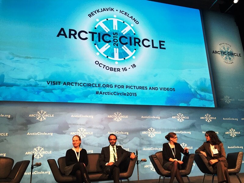 PAGE21 project was featured in a plenary session "Permafrost in the 21st century" at the 2015 Arctic Circle conference in Reykjavik,...
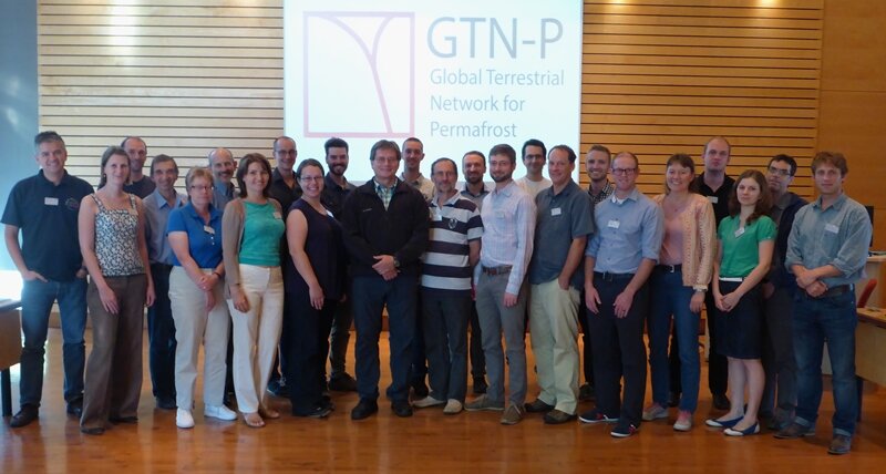 The 2nd GTN-P National Correspondents Workshop, held in Quebec, Canada, 19-20 September 2015, accomplished the data policy and...
 At the top of Rodinka looking northwest.") (Photo: Fanny Kittler) At the top of Rodinka looking northwest.Tuesday, 16th of July 2013
(Photo: Fanny Kittler) At the top of Rodinka looking northwest.Tuesday, 16th of July 2013
 Rodinka hill.") (Photo: Fany Kittler) Rodinka hill. Yesterday we went to the so-called "Bulldozer site", one of the several longstanding observation sites managed by our Russian colleagues from the Northeast Scientific Station.
(Photo: Fany Kittler) Rodinka hill. Yesterday we went to the so-called "Bulldozer site", one of the several longstanding observation sites managed by our Russian colleagues from the Northeast Scientific Station.
 Impressions from the bulldozer site. Left to right: Min Jun Kwon, Sam (Polaris project: http://www.polarisproject.org/ ), Elise (Polaris project), Nikita Zimov (north east science station), Mathias Göckede and Olaf Kolle.") (Photo: Martin Hertel) Impressions from the bulldozer site. Left to right: Min Jun Kwon, Sam (Polaris project: http://www.polarisproject.org/ ), Elise (Polaris project), Nikita Zimov (north east science station), Mathias Göckede and Olaf Kolle. In the next year (2004), for about half of the previously cleared area another 30-40 cm of soil was removed, further exposing the underlying permafrost to warming from above. Instruments were operated until about 2010, with new instruments in place at the third site since 2012, operated by the University of Alaska in Fairbanks.
(Photo: Martin Hertel) Impressions from the bulldozer site. Left to right: Min Jun Kwon, Sam (Polaris project: http://www.polarisproject.org/ ), Elise (Polaris project), Nikita Zimov (north east science station), Mathias Göckede and Olaf Kolle. In the next year (2004), for about half of the previously cleared area another 30-40 cm of soil was removed, further exposing the underlying permafrost to warming from above. Instruments were operated until about 2010, with new instruments in place at the third site since 2012, operated by the University of Alaska in Fairbanks.